Loading Tile Data into ArcGIS Pro

Objective: Tile Data in ArcGIS Pro
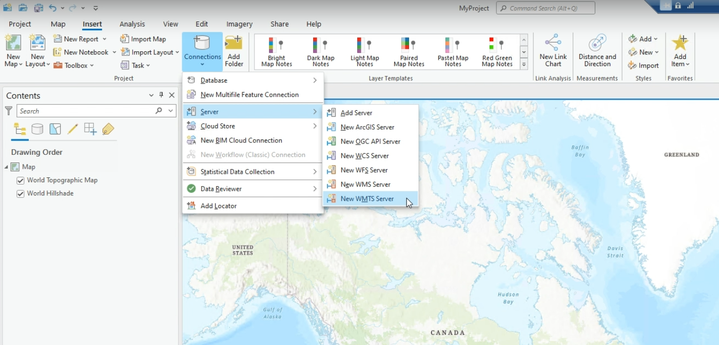
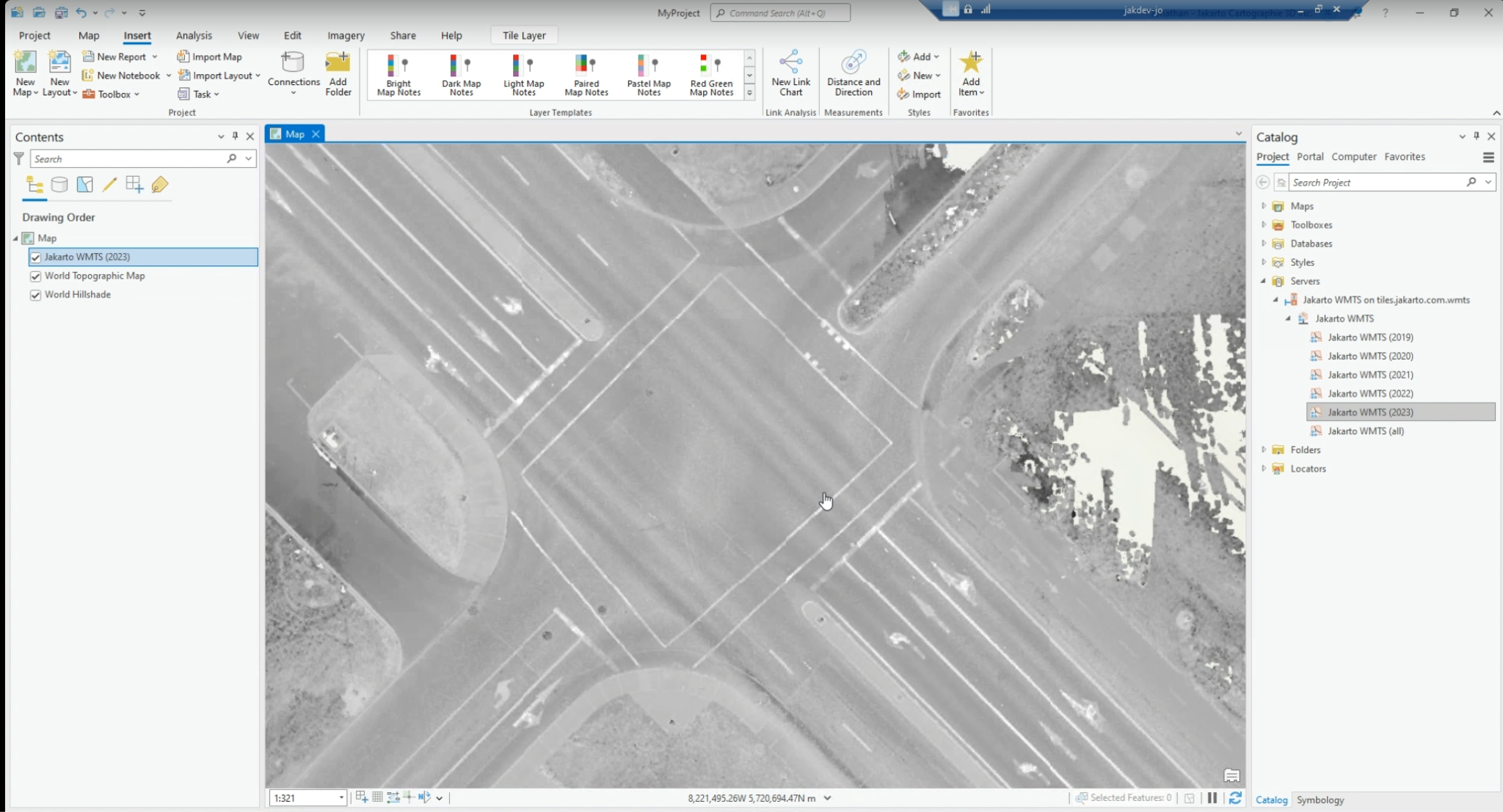
This tutorial was created using ArcGIS Pro software.

Steps to follow:

  1. Go to "Connections" and add a "New WMTS Server"

New WMTS Connection
  1. Enter the tile server URL as described here: https://tiles.jakarto.com/v1/wmts Use your platform login credentials.

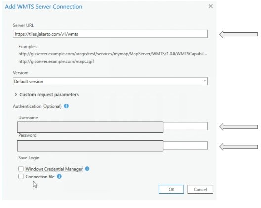
WMTS Server Connection in ArcGIS Pro
  1. You now have access to the tile data from your ArcGIS Pro Catalog window.

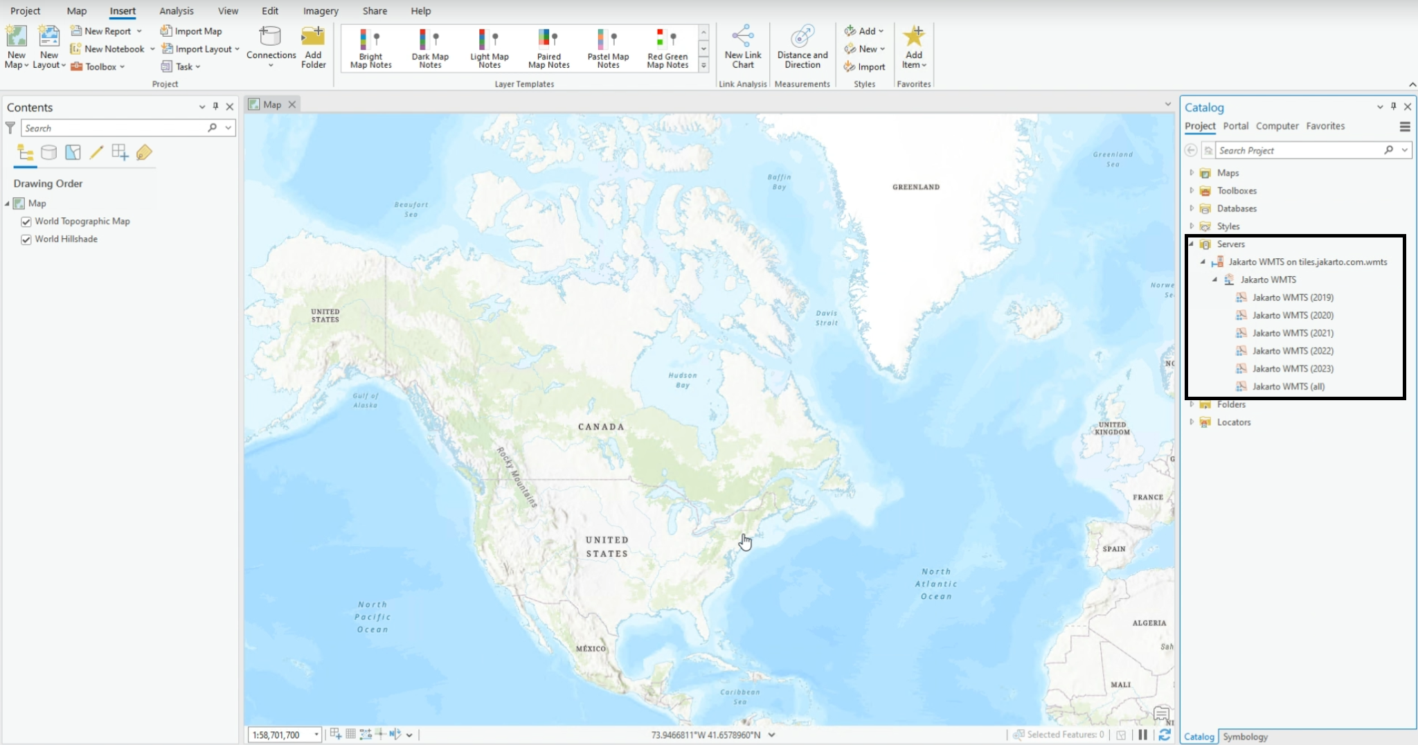
Tile data available in the Catalog

If the Catalog panel is missing from the screen, please add Jakarto's tile data from the View menu > Catalog View > Servers > Jakarto WMTS.

  1. Select the corresponding year of the passage you're interested in and add this layer to your map.

  2. Once the layer is added to your map, right-click on the layer to access its properties:

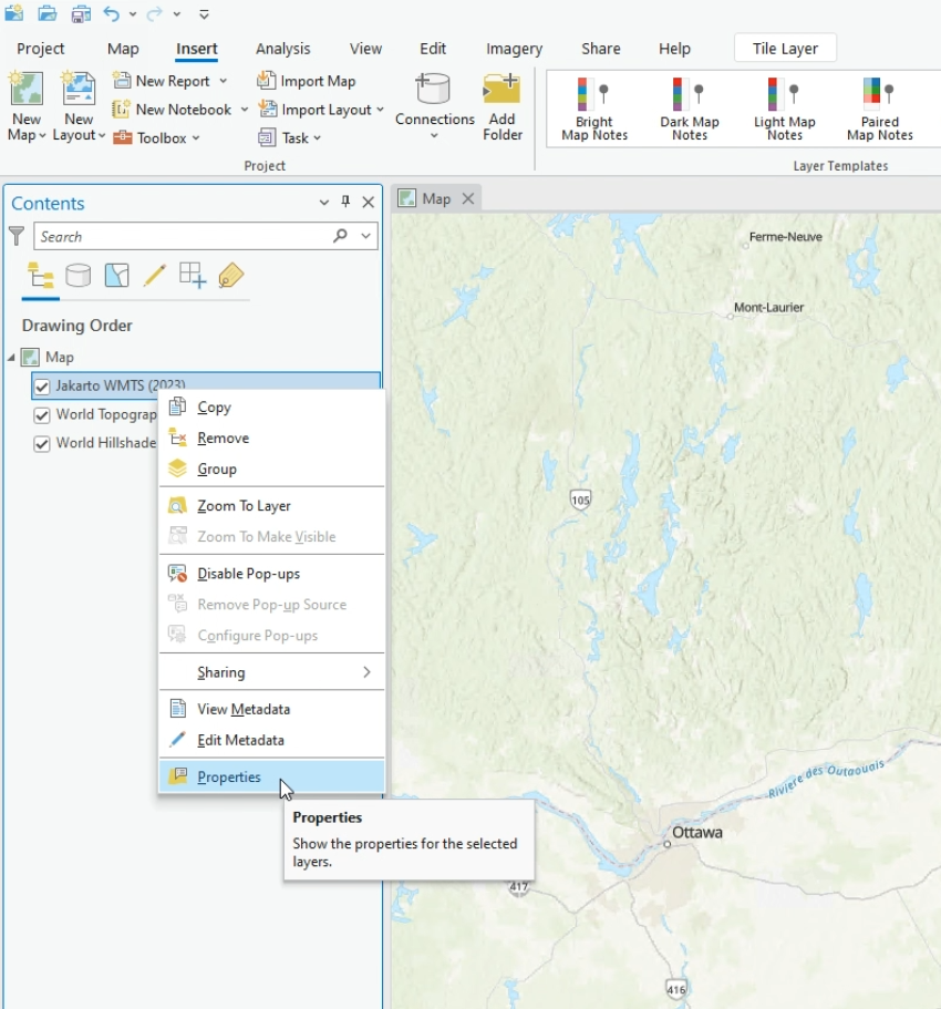
View Layer Properties
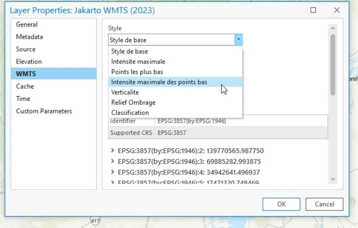
  1. You can adjust the layer style and matrix projection system:

  • Select the style from the available styles.

Style Selection

* Select the coordinate system for the tiles to be displayed.

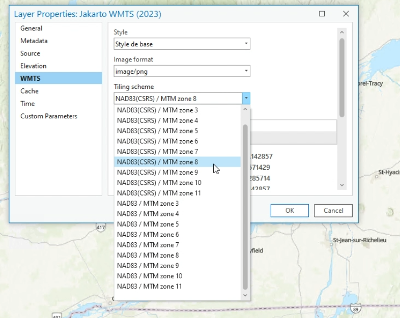
Projection Selection
  1. You now have Jakarto's tile data in your GIS.

Tile Data in Your ArcGIS Pro GIS

Last updated